
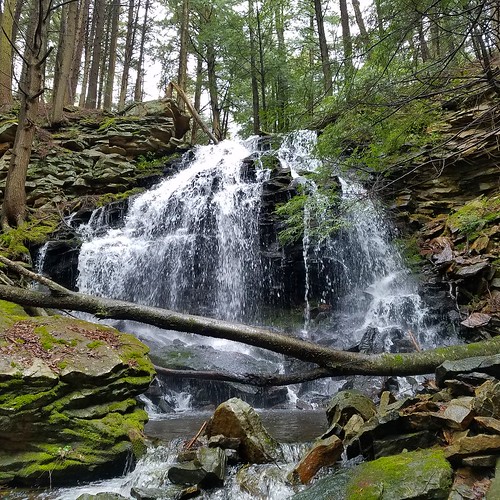
One of the Loyalsock State Forest’s best kept secrets is Tamarack Falls. In my opinion, it is one of the most scenic falls in the state forest due to its beautiful hemlock shaded grotto with fractured cliffs and cascades. It really feels like a place set apart.

I parked along Loyalsock Road where it crosses Tamarack Run. From there it was an off trail hike south (or downstream) along the creek. The terrain is rocky, but the scenery is simply breathtaking with bogs, hemlocks, and deep green carpets of moss.
I crossed a gated forest road and continued along the creek, as it tumbled among moss covered rocks between boggy areas. I then entered the top of the gorge and I soon reached the top of Tamarack Falls. It is best to see and approach the falls from the east side, or left if descending along the creek. There is a stunning hemlock grotto with rapids and cascades below the falls. Be careful descending to the creek and be sure to hike around the cliff rim. The cliff is fractured and features a small cave. Be careful of the loose rock along the creek. The scenery is simply stunning.

The falls is about 20-25 feet tall and widens as the water drops. Ledges and boulders large crown the glen. Cascades continue below the falls and out of the glen. There is also an old grade at the bottom of the glen.

Afterwards I stopped by Sones Pond and continued north to PA 87. Along Rock Run Road I saw some beautiful seasonal falls on the left. I suspect some other streams in this gorge may also have waterfalls, but that will be an exploration for another day.
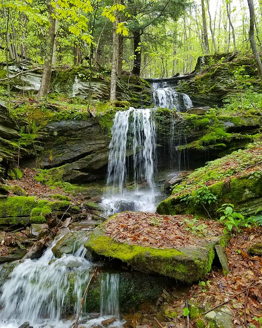
Want more waterfalls? Nearby is Coal Run, the outlet of Sones Pond, which has three or four off trail falls.
Enjoy this special place.
More photos.
************************
Hiking to Tamarack Falls is easy, but off trail.
For the longer and more scenic route:
- Park along Loyalsock Rd. where it crosses over Tamarack Run. N 41 28.584 W 76 31.891
- Hike south along Tamarack Run for about .75 of a mile.
- Reach the top of Tamarack Falls, go on the left or east side. Descend carefully, hiking around the ledges at the top.
- Tamarack Falls are at N 41 28.094 W 76 31.880.
- Retrace your steps.
- Park here along Loyalsock Rd. N 41 28.296 W 76 31.695
- Walk to the right, counterclockwise, around deer fence.
- Leave deer fence when you hear the sound of a falls, descend to the creek.
- Hike to the above coordinates for Tamarack Falls.

How driveable is Rock Run road? It looks like a gravel road for 3 miles to the coordinates you have. Is the area well marked to the waterfall?
The road is in good shape, but there are no blazes to the falls.