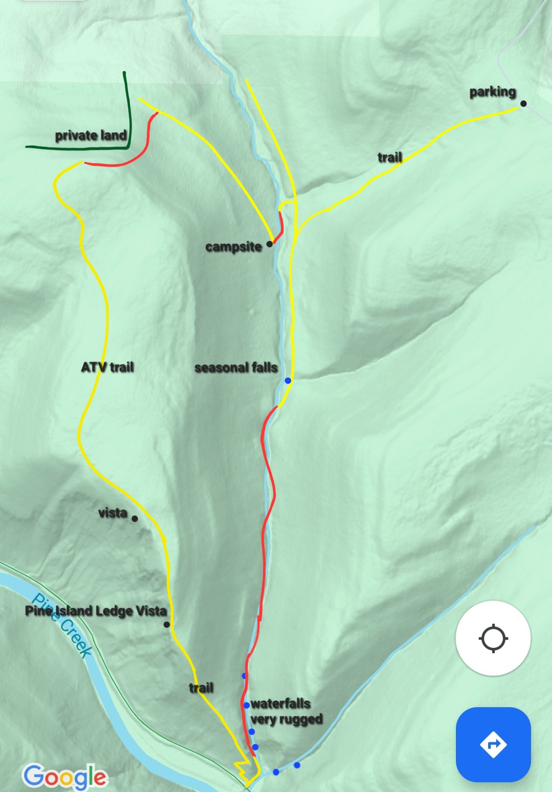
Length: Estimated from maps, I did not track it. The yellow dot route I took is about 22 miles. Using the purple shortcut (recommended) about 19-20 miles.
Difficulty: Moderate. Similar to Old Loggers Path. Biggest climbs/descents are about 600 vertical feet.
Parking: There are two recommended parking areas. I parked at a large pull off on West Branch Road. This is ideal for camping at or near Ford Hollow Shelter and the west end of the loop. It is located at 41.677246, -77.804280 . You will see a sign for the Hopper House Hollow Trail.
The other trailhead is Patterson State Park, located on the west end of the loop. Do not park in the camping area. Park on the east or north side of PA 44. 41.696082, -77.892880
Blazes: Trails are generally blazed well and most junctures have signs. Navigation was easy. West Branch and East Fork Trails are yellow and or red, but mostly red. Susquehannock Trail System (STS) is orange.
Amenities: Pit toilets at Patterson State Park, Ford Hollow Shelter.
Direction of description: Counterclockwise from West Branch Road (Hopper House Hollow Trail).
Highlights: Extensive meadows, beaver dams and ponds, a few views, scenic forests, streams, isolation, gorges, many meadow views, wildlife, birdlife, wildflowers, dark skies for stars.
Trail conditions: Overall, pretty good. You can expect overgrowth in summer. West Branch Trail (WBT) has areas with narrow, eroded sidehill and pickers that thankfully weren’t too thorny. STS is well blazed and maintained. East Fork Trail (EFT) has a better hiking tread than WBT but has more climbing. In some places the trails may be faint, but can be followed.
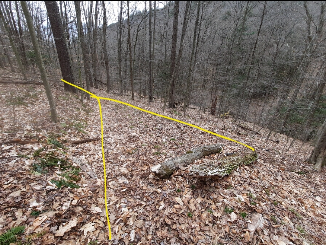
Navigation issues: I noticed two, both on EFT. If hiking counterclockwise, it is easy to miss the turn onto Switchback Trail and continue straight onto Shinglebolt. There is a trail sign. West of Junction Road, the EFT follows a pipeline swath a short distance from the top of the hill down to the road.
Maintained by: the Susquehannock Trail Club, support these volunteers.
Map of loop and surrounding trails
Description: This is the best weekend backpack loop hike you never knew existed. I was absolutely impressed by it and will surely hike it again. The WBT and EFT serve as cross connectors to the STS. By combining all the trails, you can make a truly beautiful loop.
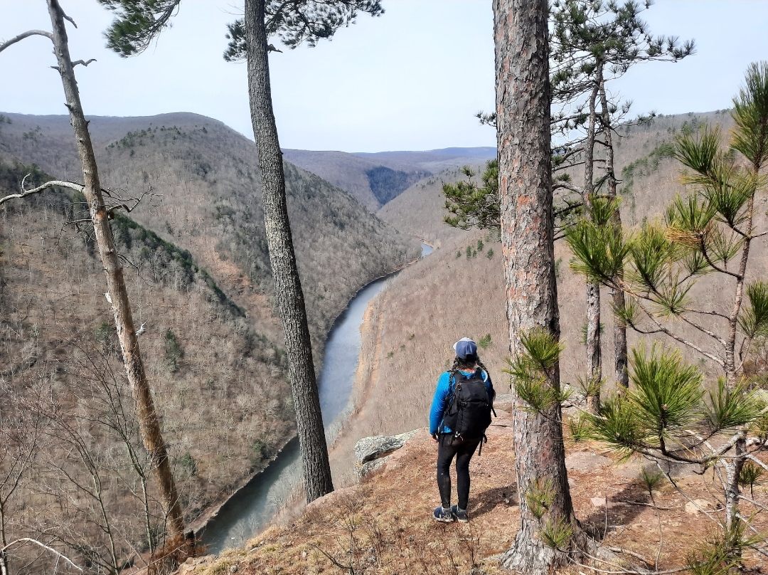
This loop is different than other trails in PA. It feels isolated and has views, just not what you might expect. You will have many meadow views over marshes, beaver ponds and dams. And there’s a lot of beaver ponds and dams. The signature view of the loop is Boone Run Vista, it is just off the EFT and should not be missed. The moderate and cruisey terrain make this a joy to hike.
From the pull off parking area, walk a short ways on West Branch Road and turn left onto WBT. This trail offers so much scenery with meadows, beaver ponds, dams. One pond is pretty large. There are several serene views. I love this trail. Before reaching the STS, cross a small creek with potential camping. Turn left onto the STS.
The STS makes a steady climb up a bucolic forested valley with a small creek. One great thing about this loop is that you are often near creeks, though they can be a trickle or even dry up in summer. Cross PA 44 and hike through Patterson State Park. The STS is level but then descends into a gorge with a seasonal creek. Hike up into Ford Hollow which is usually flowing. Ford Hollow Shelter is a sublime spot, peaceful, isolated, and serene. Elk can be seen or heard here. It is an ideal place to camp.
A steep climb follows up Hockney Hollow. Leave the STS and follow the yellow EFT/Game Refuge Trail. Pass a small meadow with good dry camping. Cross Rock Ridge Road and descend along a logged area with fine views. The EFT down to East Fork Road becomes pure hiking bliss. It follows an old grade, it is cruisey, with superb scenery. The woods are beautiful. My favorite section was the pine forests and the beaver dams and meadows. A gorgeous stretch of trail. You might see potential campsites along the lower portions of the creek, before East Fork Road.
Turn right onto East Fork Road and follow for a half mile, turn left onto the EFT at a sign. Go up another scenic stream valley with more meadows and views. This creek becomes more wooded but the grade offers great hiking. Turn right where the EFT follows Switchback Trail, this turn can be easy to miss. Below along the creek is potential camping. Climb up an open wooded gorge with ferns and wildflowers, this is probably the steepest climb of the loop.
Reach the top and a pipeline swath, follow it to the left down to Junction Road. Time for a side hike, hike the road to the right for 1,000 feet to superb Boone Run Vista, one of the finest in the state forest. It’s a must see. Go back to the EFT.
Now you have a choice. I suggest you take the purple shortcut on the map below. I hiked the EFT on the railroad grade to the STS. It’s nice, don’t get me wrong, the grade was cool and the hiking was mostly level to the STS, but there isn’t much scenery to justify the effort, especially since you must descend and then climb up from the grade on the STS. The purple route does miss Cherry Springs Vista, but Boone Run Vista is a better view anyways.
The final stretch is Hopper Trail/Hopper House Hollow Trail. It’s a nice gem I enjoyed. Begin by crossing small meadows and enter a serene wooded gorge with a seasonal creek. If it’s running, there is some great streamside hiking. There is a small campsite at Cross Trail. The creek becomes larger and West Branch Road comes into view through the trees. This trail remains enjoyable to the end where it delivers you back to the car.
As you hike this loop, you will see many other trails connecting to it. There is a vast network of trails here and many loop options. These trails need more hikers so please explore them.
I loved this loop and I think you will as well.


Legend:
Yellow dots: route I took
Purple dots: suggested shortcut route
C: camping or potential campsites