

Emerald Forest, SGL 57
This is one of the most scenic loop hikes in Northeast Pennsylvania. It features Scouten Brook, a tumbling mountain stream with cascades and waterfalls, an off trail hike to Cali Falls, and one of PA’s most scenic forests, the Emerald Forest, with its deep green canopy of hemlock and spruce, with carpets of moss. Another short off trail hike will take you to a fine vista, great for sunsets, and massive boulders with passageways and overhangs.
This loop is approximately 7-8 miles long.

The trickiest part of the hike is the very beginning. The remainder of the hike follows well established old grades and logging roads, although there are no blazes or signs. Of course, the hike to Cali Falls, Zion Rocks, and the vista are off trail.

Drive down Windy Valley Road from Forkston, cross the bridge, and about .4 mile further reach Scouten Brook Road, a private road on the left. Slow down. Cross over Scouten Brook and pass a white cabin on the left. The game lands touch the road just past the cabin at 41.483737, -76.133386. Pull off as best you can, parking is very limited. You may notice the white blazes on the trees, which are the game lands boundary.

Enter the woods, there is no trail. Some mobile homes are off to your right. Walk back, slightly southeast, for about 1,000 feet, and reach an old forest road; turn left as it curves uphill. Enter a forest with some pines and continue a climb before the grade descends. There’s a grade on the left; take it. The grade straight ahead is your return route.
Reach views of Scouten Brook, and in winter, an old log cabin off to your left. Reach another grade, turn right on it and follow it up Scouten Brook. The grade stays above the creek and offers many views of it in winter. There are cascades and small falls. Some parts of the grade are eroded. A side glen comes down on the north side of the brook; this is where Cali Falls is located. It is a seasonal falls, so if Scouten Brook is low, Cali Falls will be dry. The cascades and falls on Scouten become larger with some large boulders and pools.
Reach where the two forks of Scouten Brook join. The grade turns left, above Scouten Brook Falls, a wide ledge about 12 feet tall. Now climb and veer right and hike across the other fork of the brook. The grade soon levels and reaches another grade, make a sharp left. This grade is often wet and makes a gradual ascent. Reach a four way intersection; turn right. You will soon reach another intersection, turn right. The grade ascends slightly and soon enters a stunning spruce forest. The terrain is rolling and the forest becomes more scenic the further you hike, this is the Emerald Forest. There are wet areas. This evergreen forest is comprised of hemlock and spruce, with some pine. Moss covers the ground. It is like hiking in Maine or Quebec. This forest is very beautiful.
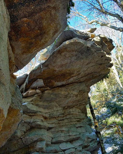
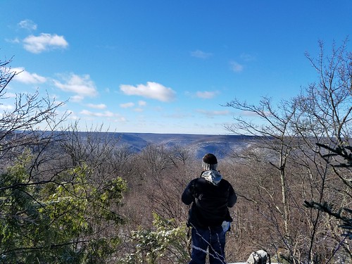
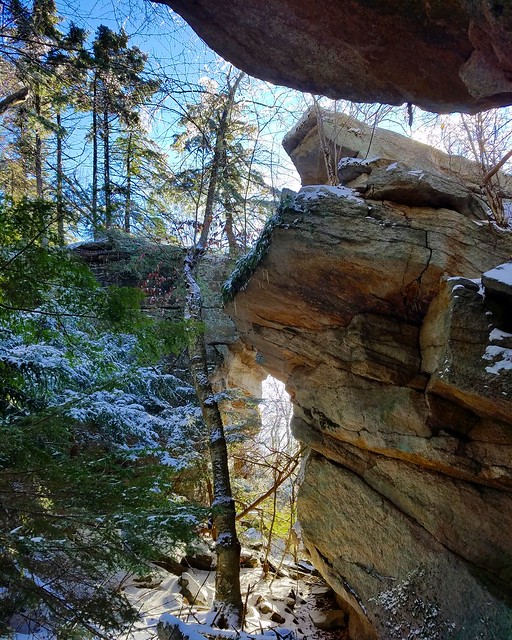
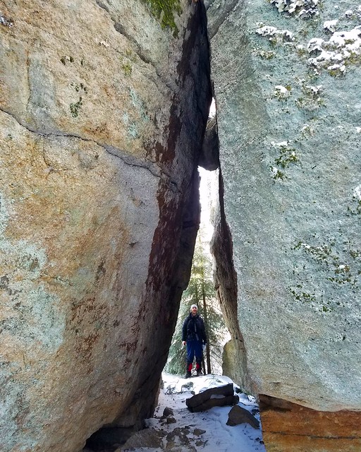
Where the grade begins to descend, and before it leaves the Emerald Forest over some boulders and ledges, you can hike off trail to the south to see the vista and Zion Rocks. The vista is a window opening through the trees to the vast plateaus to the west. It is notable for its isolation, no sign of development, and the plateaus look particularly impressive here. It is also a good sunset vista. Below the vista are a maze of massive boulders. About 500 feet north of the vista are the incredible Zion Rocks where huge mansion-sized boulders feature overhangs, caves, and crevices.
Back on the trail, descend and leave the Emerald Forest. The trail levels and then drops down the benches of the mountain. Two other grades join from the left but continue straight. The trail curves right and descends. Reach another grade and turn left, continuing the descent, which can be steep in places. Reach the point where you began the loop and retrace your steps.

Please treat this special place with respect. The Emerald Forest is unique in PA for its size, composition, and scenery; help make sure it will be there for generations to come.

More photos.


Is there an easier way to get into the Emerald Forest from the southeast side in Forkston township? I’d like to photograph it, but don’t want to haul all my gear through the hike coming from the northwestern part of the loop you outlined. Any help would be greatly appreciated!
No, there it isn’t, at least not without crossing private property. The grade up Scouten Brook is the easiest way.